


Montreal DistrictsVerdunThe District
*There appears to be no way to omit the InfoWindow on the Google Map, but when you click on the map the bubble disappears. 
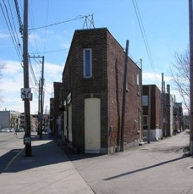
The road was extremely important because it crossed the territory and linked the Paroisse des Saints-Anges of Lachine to the Paroisse de Notre-Dame of Montréal. At the beginning of the 19th century, the aspect of the territory is transformed by the construction of the Montreal Aqueduct that encloses the district on its northern side. Its rather difficult to imagine the district without the canal. After it had been built, the residents who wanted to go to Côte Saint-Paul could, much to their pleasure, cross one of the many bridges that hang over the canal. They still do. Downtown is bordered by the Highway 15 also called Décarie Expressway in the east, by the Desmarchais Boulevard in the west, by the canal of the Montreal Aqueduct in the north and by the St-Lawrence River in the south. In 1991, about half of the population of the district resided in this enclosed area. Architecture Movements What still strikes is the disparity between the various sectors. In the east, the territory kept its old houses dating back to the 1930s. In the centre and in the west, in the Desmarchais-Crawford area, houses dating back to the 1940s and 1950s still dominate the scenery. In the 1970s, new houses were built on the ruins of old or damaged ones. The few rare grounds that were still available such as those located on the banks of the River between LaSalle Boulevard and the St-Lawrence River were used to build new houses. The Desmarchais-Crawford area is residential and bordered to the east by the Desmarchais Boulevard, to the west by the limits of LaSalle, to the north by the canal of the Montreal Aqueduct and to the south by the St-Lawrence River. At the end of Woodland close to the LaSalle Boulevard, rises an extremely interesting building signed by the architect Jean-Maurice Dubé. The Centre d'hébergement du Manoir with a capacity of 320 rooms was inaugurated in 1970. Except for the Poudrière that now houses condos, the three Metro Stations built in 1978, LaSalle, de lÉglise and Verdun did not bring any major modifications to the urban landscape of the district. The vast vacant grounds left by the demolition of the old Defence Industries Limited (DIL) factory in 1980 however yielded the place for condos and metamorphosed the area. Ultimately, the size and the quality of the districts various housing developments became quite diversified. They reflect the various fortunes and social conditions of the inhabitants, as well as the inherent qualities and defects of a normal urbanization process. Île-des-Soeurs (MBK)
More to come soon. |