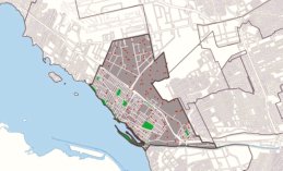
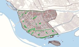
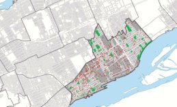
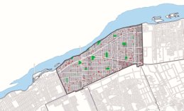
Montreal Kit

Montreal Districts


The term Montreal Districts is not used by the City of Montreal except when referring to electoral districts. We use the word district as a way to separate formal borough information from informal area information supplied by you and me.

The profiles of the Montreal Boroughs follow the electoral divisions of the City of Montreal such as they have been since January 1, 2006. The Montreal Districts, on the other hand, are a bit historical and descriptive and largely informative and conversational. This is the way this site has been planned "we build a city and then we ask people to join in".

For more information about Montreal, you may visit Sherlock, the municipal information bank and, for more statistics, you may visit Montréal en Statistiques. You may also be interested by the following two pages from the Official City Portal, Mises en chantier résidentielles and City of Montreal – Property Assessment Roll


Ahuntsic / Cartierville

Employment in Ahuntsic-Cartierville

  • In Ahuntsic and in Cartierville, one resident out of three is an immigrant.
  • The two districts are home to one of the largest number of people aged 65 and more.
  • On the North side, Ahutsic and Cartierville are bordered by the Rivière-des-Prairies.

Ahuntsic / Cartierville

Local Street Map of Ahuntsic-Cartierville (PDF)
Montréal en statistiques Ahuntsic-Cartierville
Ville de Montréal Ahuntsic-Cartierville

Anjou

Employment in Anjou

  • In Anjou, three out of four residents are native French speaking.
  • Almost half of the households established in Anjou are home owners.
  • Anjou offers a sizeable industrial park with a large variety of companies.

Anjou

Local Street Map of Anjou (PDF)
Montréal en Statistiques Anjou
Ville de Montréal Anjou

Côte-des-Neiges / Notre-Dame-de-Grâce

Employment in Côte-des-Neiges-Notre-Dame-de-Grâce

  • In CDN-NDG, nearly one resident out of two is an immigrant.
  • Both districts are bordered by the Mont-Royal and the Saint-Jacques cliff.
  • Of all the Montreal districts, Côte-des-Neiges and Notre-Dame-de-Grâce are the most populated.

Côte-des-Neiges / Notre-Dame-de-Grâce

Local Street Map of Côte-des-Neiges-Notre-Dame-de-Grâce (PDF)
Montréal en Statistiques Côte-des-Neiges-Notre-Dame-de-Grâce
Ville de Montréal Côte-des-Neiges-Notre-Dame-de-Grâce

L'Île-Bizard / Sainte-Geneviève

Employment in L'Île-Bizard-Sainte-Geneviève

  • Both districts, L'Île-Bizard and Sainte-Geneviève, are mostly residential.
  • The borough is one of the least populated and with the least number of immigrants.
  • L'Île-Bizard and Sainte-Geneviève are surrounded by lake Deux-Montagnes and Rivière-des-Prairies.

l'Île-Bizard / Sainte-Geneviève

Local Street Map of L'Île Bizard-Sainte-Geneviève (PDF)
Montréal en Statistiques L'Île-Bizard-Sainte-Geneviève
Ville de Montréal L'Île-Bizard-Sainte-Geneviève

Lachine

Employment in Lachine

  • Significant disparities exist between Lachine East and Lachine West.
  • The number of immigrants living in Lachine is one of the lowest in Montreal.
  • Lachine is bordered by the Saint-Laurent River and is close to the Pierre-Elliott-Trudeau International Airport.

Lachine

Local Street Map of Lachine (PDF)
Montréal en Statistiques Lachine
Ville de Montréal Lachine

LaSalle

Employment in LaSalle

  • LaSalle offers the highest number of jobs in the manufacturing industry.
  • The borough is bordered by the Lachine Canal, the Aqueduc Canal and the Saint-Laurent River.
  • In LaSalle lives a high number of post-secondary graduates in commerce and in business management.

LaSalle

Local Street Map of LaSalle (PDF)
Montréal en Statistiques LaSalle
Ville de Montréal LaSalle

Mercier / Hochelaga-Maisonneuve

Employment in Mercier-Hochelaga-Maisonneuve

  • The residents of Mercier-Hochelaga-Maisonneuve live in three distinct housing areas.
  • The three areas are separated from each other by large industrial sectors and major roads.
  • Non-profit organizations and cooperatives occupy a large and important part in the borough economy.

Mercier / Hochelaga-Maisonneuve

Local Street Map of Mercier-Hochelaga Maisonneuve (PDF)
Montréal en Statistiques Mercier-Hochelaga-Maisonneuve
Ville de Montréal Mercier-Hochelaga-Maisonneuve

Montréal-Nord

Employment in Montréal-Nord

  • Of all the Montreal districts, Montréal-Nord is the most densely built.
  • In Montréal-Nord, the presence of immigrants of Italian and Haitian origins is rather high.
  • Residents in Montréal-Nord profit from a large amount of cultural, recreational and sporting activities and facilities.

Montréal-Nord

Local Street Map of Montréal-Nord (PDF)
Montréal en Statistiques Montréal-Nord
Ville de Montréal Montréal-Nord

Outremont

Employment in Outremont

  • Outremont is the smallest Montreal borough and district.
  • Outremont is a borough with the largest number of women residents.
  • Outremont is a residential district where a certain Montreal elite chooses to reside.

Outremont

Local Street Map of Outremont (PDF)
Montréal en Statistiques Outremont
Ville de Montréal Outremont

Pierrefonds / Roxboro

Employment in Pierrefonds-Roxboro

  • Pierrefonds and Roxboro are primarily residential districts.
  • The borough is more that 300 years old with 300 years of history.
  • The territory follows the Rivière-des-Prairies for a distance as long as 29.5 km.

Pierrefonds / Roxboro

Local Street Map of Pierrefonds-Roxboro (PDF)
Montréal en Statistiques Pierrefonds-Roxboro
Ville de Montréal Pierrefonds-Roxboro

Plateau-Mont-Royal

Employment in Plateau-Mont-Royal

  • The largest number of francophones lives on the Plateau.
  • The Plateau-Mont-Royal is located in the centre of the City of Montreal.
  • Compared to all Montreal districts, the Plateau has the lowest number of senior citizens living on its territory.

Plateau-Mont-Royal

Local Street Map of Le Plateau-Mont-Royal (PDF)
Montréal en Statistiques Plateau-Mont-Royal
Ville de Montréal Plateau-Mont-Royal

Rivière-des-Prairies / Pointe-aux-Trembles

Employment in Rivière-des-Prairies-Pointe-aux-Trembles

  • Rivière-des-Prairies and Pointe-aux-Trembles are the largest Montreal districts.
  • Both districts are bordered by the Saint-Laurent River and the Rivière-des-Prairies.
  • The number of home owners in both districts is the equivalent of twice the Montreal average.

Rivière-des-Prairies / Pointe-aux-Trembles

Local Street Map of Rivière-des-Prairies-Pointe-aux-Trembles (PDF)
Montréal en Statistiques Rivière-des-Prairies-Pointe-aux-Trembles
Ville de Montréal Rivière-des-Prairies-Pointe-aux-Trembles

Rosemont / La Petite-Patrie

Employment in Rosemont-La-Petite-Patrie

  • The borough is one with the largest number of jobs offerings.
  • The borough is one with the lowest number of young people.
  • Of all the Montreal districts, Rosemont and La-Petite-Patrie are among the most populated.

Rosemont / La Petite-Patrie

Local Street Map of Rosemont-La-Petite-Patrie (PDF)
Montréal en Statistiques Rosemont-La-Petite-Patrie
Ville de Montréal Rosemont-La-Petite-Patrie

Saint-Laurent

Employment in Saint-Laurent

  • Saint-Laurent is a leader in hosting and integrating new immigrants
  • Saint-Laurent is known for the diversity and the quality of the services provided to its residents.
  • Saint-Laurent is known for the many jobs offered by a large variety of companies established on its territory.

Saint-Laurent

Local Street Map of Saint-Laurent (PDF)
Montréal en Statistiques Saint-Laurent
Ville de Montréal Saint-Laurent

Saint-Léonard

Employment in Saint-Léonard

  • The population of Saint-Léonard is more and more multicultural.
  • Because of many large boulevards, the traffic is usually smooth and fast.
  • The location of Saint-Leonard serves its development and stimulates its economy.

Saint-Léonard

Local Street Map of Saint-Léonard (PDF)
Montréal en Statistiques Saint-Léonard
Ville de Montréal Saint-Léonard

Le Sud-Ouest

Employment in Le Sud-Ouest

  • Le-Sud-Ouest is one of the oldest borough and district in Montréal.
  • The fate of the Sud-Ouest has always been closely linked to the Lachine Canal.
  • During the next few years, Le-Sud-Ouest will have to face important challenges.

Le Sud-Ouest

Local Street Map of Le Sud-Ouest (PDF)
Montréal en Statistiques Le Sud-Ouest
Ville de Montréal Le Sud-Ouest

Verdun

Employment in Verdun

  • Verdun offers a cycling network of more than 25 km.
  • Verdun has three distinct areas that combine nature, water and urbanity.
  • Verdun is bordered by the Saint-Laurent River, the Lachine Rapids and the Aqueduc Canal.

Verdun

Local Street Map of Verdun (PDF)
Montréal en Statistiques Verdun
Ville de Montréal Verdun

Ville-Marie

Employment in Ville-Marie

  • Ville-Marie is bordered by the Mont-Royal and the Saint-Laurent River.
  • The highest number of jobs and commercial activities are all found in Ville-Marie.
  • Most of the international organisations based in Montreal are located in Ville-Marie.

Ville-Marie

Local Street Map of Ville-Marie (PDF)
Montréal en Statistiques Ville-Marie
Ville de Montréal Ville-Marie

Villeray / Saint-Michel / Parc-Extension

Employment in Villeray-Saint-Michel-Parc-Extension

  • The borough is well served by effective road networks and public transit.
  • Villeray, Saint-Michel and Parc-Extension feature sports facilities known internationaly.
  • Unlike other Montreal districts, nearly half of the local workforce uses public transit to go to work.

Villeray / Saint-Michel / Parc-Extension

Local street map of Villeray-Saint-Michel-Parc-Extension (PDF)
Montréal en Statistiques Villeray-Saint-Michel-Parc-Extension
Ville de Montréal Villeray-Saint-Michel-Parc-Extension

Thank you for visiting Montreal Districts.
More to come soon.

Montreal Kit
Montreal Boroughs / Montreal Cities

Map of the Island of Montreal

Maps of Montreal / Montreal Metro Map
Official City Portal Ville de Montréal

TOP

Exit Montreal Districts
and go to Montreal Kit Home Page

Montreal Districts
What district am I in?


Ahuntsic

Anjou

Cartierville

Côte-des-Neiges

Hochelaga-Maisonneuve

Île Bizard

Lachine

LaSalle

Mercier

Montréal-Nord

Notre-Dame-de-Grâce

Outremont

Parc-Extension

Petite-Patrie

Pierrefonds

Plateau-Mont-Royal

Pointe-aux-Trembles

Rivière-des-Prairies

Rosemont

Roxboro

Sainte-Geneviève

Saint-Laurent

Saint-Léonard

Saint-Michel

Sud-Ouest

Verdun

Ville-Marie

Villeray


Atlas de l'emploi

Montreal Employment Maps

Images Montréal

Images Montreal is a huge project that aims to be the biggest exclusive website of Montreal's skyscrapers, historical buildings and architecture landmarks.

Old historical monuments have a lot of interest as much as new apartment buildings, new skyscrapers or graffitis.


Montreal by Metro

Montreal by Metro is an unofficial website for fans of Montreal's metro system.

Our modern rapid transit system is one of the most architecturally distinctive subway systems in the world.

Unlike many other subway networks, every station in Montreal is distinct.

The system is beautifully decorated with hundreds of pieces of public art, including sculptures, frescoes, and stained glass.


STM Montréal

STM Montreal is composed of 68 metro stations spread along four lines and of a network made of 170 daytime and 20 night time bus service routes.

The metro provides 1.3 million trips every day. STM Montreal web site also offers a section called Art in the Métro.